UN
12a Sands Close
£ 210,000
Description
We don't have a Description for this property.
- Bedrooms
- 1
- Bathrooms
- 0
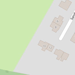


Leaflet © OpenStreetMap contributors
The heatmap indicates the level of crime in the area. The color of the heatmap indicates the crime severity and recency.
Metrics Year-on-Year
- Average area value
- 1,062,500.00 £Increased by 55.49 %
- Average area rental value
- 2,115.00 £/moDecreased by 6.79 %
- Est rental Yield
- 2.39 %Decreased by 39.95 %
- Crime Rate
- 8.00 %Unchanged by 0.00 %
from 683,325.00 £
from 2,269.00 £/mo
from 3.98 %
from 8.00 %
Nearby Schools
| Name | Type | Ofsted | Distance |
|---|---|---|---|
| Barfield Prep School | Other Independent School | 2.14 KM | |
| Waverley Abbey Cofe Junior School | Academy Converter | Good | 2.47 KM |
| Park Primary School | Community School | Good | 2.91 KM |
| Sunflowers Children'S Centre | Children's Centre Linked Site | 2.92 KM | |
| St Paul'S C/E Infant School & Sure Start Children'S Centre | Children's Centre | 3.06 KM |
Images
Nearby Streets
| Name | Average Price | Average Sqft | Distance |
|---|---|---|---|
| Greenacres | £ 0 | 0 | 0.00 KM |
| The Willows | £ 0 | 0 | 0.00 KM |
| Waverley Lane | £ 0 | 0 | 0.00 KM |
| Grange Road | £ 562,222 | 0 | 0.00 KM |
Nearby Transport
| Name | NLC | TLC | Distance |
|---|---|---|---|
| Aldershot | 5623 | AHT | 4.34 KM |
| Ash | 5641 | ASH | 5.31 KM |
| Farnham | 5545 | FNH | 5.58 KM |
| Ash Vale | 5547 | AHV | 7.10 KM |
| North Camp | 5636 | NCM | 7.23 KM |
Nearby Listings
| Address | Price | Type | Score | Distance |
|---|---|---|---|---|
| The Sands, Farnham | £ 737,500 | BUY | 7 / 10 | 0.49 KM |
| Botany Hill, The Sands, Farnham, GU10 | £ 2,250,000 | BUY | 7 / 10 | 0.53 KM |
| Amberley Botany Hill, The Sands, Farnham | £ 1,650,000 | BUY | 8 / 10 | 0.58 KM |
| Sands Road, The Sands, Farnham, Surrey, GU10 | £ 800,000 | BUY | 6 / 10 | 0.73 KM |
| Crooksbury Road, Farnham, GU10 | £ 1,650,000 | BUY | 7 / 10 | 0.84 KM |
Nearby Properties
| Address | Price | Distance |
|---|---|---|
| 12a Sands Close | £ 210,000 | 0.00 KM |
| 8 Sands Close | £ 170,000 | 0.00 KM |
| Greywings | £ 680,000 | 0.32 KM |
| Haycorns | £ 815,000 | 0.33 KM |
| Whitegates | £ 1,710,000 | 0.33 KM |